The exhibition at the British Library telling the life of London in maps is a grey affair.* So it should be, for the walls and cases are necessarily packed with old engraved plans and views, and with surveys penned in neat, spindly lines. Some are worn and stained, in the way much used and very large documents get to be. Many are very rare. If your family muniment room happens to have a map of London made up of 14 engraved sheets with Houndsditch spelled ‘Unsdiche’ and the kennel for the lord mayor’s hounds labelled ‘Dogge hows’, you could well have the holy grail of London mapping. It is the first map in which the plan is a proper vertical view (even though the buildings are shown at an angle). It dates from around 1555 and no printed copy exists; three of the copper plates were preserved because pictures were painted on their backs, but all other information about it comes from later maps which, on the evidence of the surviving plates, must derive from it.
While many of the surveys are the handsome product of years of labour, and many of the views are spectacular panoramas, nearly everything here asks to be read, or to be looked at close-up, not admired from a distance. You start from what you know. Noses brush the glass as people search out the present emerging in the past, orienting themselves by following bends in the river and streets with ancient names whose routes still remain. In even the earliest views two fixed points – the Tower of London and Westminster – provide starting points. Names, too, are less fragile than buildings. There is evidence that some changes took place very quickly. The speed of rebuilding after the Great Fire was phenomenal. The spread of London westwards in the late 18th and early 19th centuries was also brisk. Some transformations teetered on the brink before falling back. John Thomas Smith’s 1680 plan of Whitehall Palace shows a confused warren of a building; only the ‘modern’ Banqueting House stands broad, thick-walled and symmetrical. This could have been the ‘before’ for a spectacular ‘after’, adumbrated by a view Knyff made in about 1688 that shows some new building, but nothing on anything like the scale of what, had Charles I survived or Charles II been in funds, would have lorded it over a long Thames frontage. Fires in 1691 and 1698 finally put an end to Whitehall Palace. Court offices were relocated in the undamaged tennis court, cockpit and tilt yard. Remnants are still to be found within the 18th and 19th-century government office buildings in Whitehall.
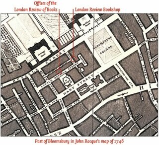
It is possible to track down sites which have vivid lives in fiction. Part of Vauxhall pleasure gardens comes just within the border of John Rocque’s wonderful London plan of 1746. He even plots the dark tree-lined alleys where Fanny Burney’s Evelina was hassled by a group of young men. She was not persuaded to taste the promised excitements of the last night of the season:
Why, Lord, it’s the best night of any; there’s always a riot – and there the folks run about – and then there’s such squealing and squalling! – and, there, all the lamps are broke, and the women run skimper scamper. I declare I would not take five guineas to miss the last night!
The gardens are still there in Horwood’s map of the 1790s – they survived until the 1850s.
The early panoramas and views are proud, boastful even, with titles and inscriptions extolling the city’s size and wealth. Such 18th-century maps as Rocque’s were expensive decorations; a contemporary catalogue suggests that the sheets should be joined up and mounted on a roller, or made into a ‘beautiful and useful screen’. The first London street atlas didn’t appear until 1854, but in the late 1600s Morgan had issued a booklet with a list of streets and, after that, London maps became less decorative (fewer amusing vignettes, plans instead of drawings of buildings) and more functional (individual house numbers, more accurate surveying). The axonometric view/map that Wenceslaus Hollar was working on, and which the Great Fire made him abandon, is, of several unrealised projects, the one most to be regretted. Had it been completed we would have been able to walk the streets of early modern London in imagination as we can walk those of Paris in Turgot and Bretez’s plan of 1739 – or come to that, of almost any modern great city by way of Google Earth. Only a single sheet was engraved, around 1658; it includes Somerset House in the south, Holborn in the north, Saint Martin’s Lane in the west and Lincoln’s Inn in the east. Hollar’s engraving of Leake’s post-fire survey (topped by a view of the fire from Southwark) gives another taste of what it might have been like.
Maps document the way pride began to be tinged with anxiety. The desire for clean water, proper sewers and free-moving traffic pressed at limits set by supply, finance, and the difficulty of promoting city-wide schemes in the absence of city-wide government. As late as 1846 a proposal for new sewers and an embankment by John Martin, the painter of red suns and apocalyptic skies, came to nothing, but his project has much in common with the scheme built by Joseph Bazalgette in the 1870s, following the establishment of the Metropolitan Board of Works.
The very extent of London now bred fear. Modern maps which plot its expansion show ever bigger splashes of black as building spreads along trunk roads and absorbs surrounding villages. They bear a sinister resemblance to records of malignant growths – which fits the recurring image of the city as a body – its roads arteries, its food markets a belly, sewers its organs of excretion, and open spaces its lungs. These open spaces were a particular focus of anxiety when lords of the manor began to enclose and build over commons and heaths. A map of 1864 shows the second Earl Spencer’s plan to fence in Wimbledon Common, selling a third or so off for housing to fund the upkeep of the remainder. Those who objected to such incursions saved Blackheath, Hampstead Heath and Epping Forest from development, as well as other open spaces, often through lawsuits of huge complexity. The fear of urban sprawl – shown by Cruikshank in The March of Bricks and Mortar, in which haycocks and trees flee in terror before chimney pots carrying loaded hods – is still alive.
When topographic maps are used as a base, managed hierarchies of information disappear under an overlay of colour – very often bright colour. Geological maps, marbled with the laminar streaks of sedimentary rocks in yellow, green and brown and sprinkled with the great red plums of granite, have always been strident. There are none of those here, but there are examples of topographical maps overpainted with emphatic information of other sorts. In one, Second World War bomb damage is recorded and in another Charles Booth details the wealth or poverty of households. Black indicates total destruction in the former and abject poverty in the latter; yellow indicates upper-class wealth and minor blast damage.
The first maps of London were more decorative than functional. When it came to creating co-ordinated sewerage, a detailed, measured survey done with the kind of accuracy which had in the past been used to determine the boundaries of particular estates – and even more accurate information about relative heights – was needed for all of London. The latter part of the exhibition is about the planning and promotion of change on that scale. Even though the layers of development embedded in modern London, each century having resown and retilled the field, have replaced the coherent, low-rise, spire-dotted, self-explanatory city of the early views with a confusing patchwork, there is enough left for this exhibition to raise ghosts as you walk in Southwark or along Whitehall.
Send Letters To:
The Editor
London Review of Books,
28 Little Russell Street
London, WC1A 2HN
letters@lrb.co.uk
Please include name, address, and a telephone number.


