Handkerchief Maps
Georgina Kenyon
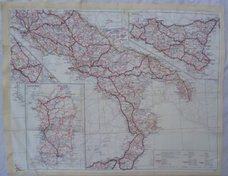
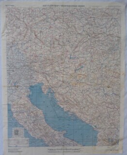
I have three half-metre-square maps of southern Europe framed on my living-room wall. Printed by the American air force on acetate rayon – lightweight, waterproof and hard to tear – the ‘handkerchief maps’ were given to my father-in-law, Howard Walker, who flew with the Australian Air Force during the Second World War. He started operational flying from Brindisi in October 1944, in Lancaster bombers that dropped supplies – guns, explosives, food and clothing – for partisans in northern Italy, Yugoslavia and northern Greece. ‘My job,’ he says, ‘was to ride up in the perspex nose of the plane to pick out landmarks of any sort that would help the navigator affirm or correct the plane’s course.’
They were frequently shot at. ‘At first you feel the jolt of the supersonic air blast, then the thumping explosion, then see the dirty greasy-looking puff of dark smoke that has missed you. Being off course over enemy territory and not knowing where you are is nerve-racking too, especially at night.’
The detailed maps were a crucial escape aid in case the plane was shot down. Each man was also issued with a packet of high-energy glucose cubes, a razor, water-purifying tablets, a comb, a fishing line and hook, a pocket knife with a pig sticker and a can opener on it, a needle and thread, and a compass. And a pair of dry socks.


Comments